R&D&i


DEVELOPMENT OF A GEOSPATIAL DATA BROWSER SYSTEM


FILE CODE IDI-20191137

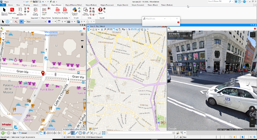
Project Infraplan Geospatial , ttitled "Development of a Geospatial Data Browser System," aims to develop a geospatial data search system that can be used in web environments or as a plugin in third-party spatial tools to search for geo-spatial data available in Spatial Data Infrastructures (SDIs), geo-portals, Open Data portals, APIs, and private data of the user or organization. The project has been funded by CDTI in the PID line with the file number IDI-20191137.

PROGRAM
R&D CDTI projects
COLLABORATORS
ASET
TOTAL COST
332.067,00 €
SUBSIDIZED
74.715,08 €


SPONSORS

COLLABORATORS


AUTOMATIC EXTRACTION OF DATA FROM MOBILE MAPPING CAPTURES USING DEEP LEARNING AND ARTIFICIAL INTELLIGENCE TECHNOLOGIES


FILE CODE IDI-20210955

Project AI-Infraplan Geospatial , titled "Automatic Extraction of Data from Mobile Mapping Captures using Deep Learning and Artificial Intelligence Technologies," aims to conceptualize, design, and develop a data extraction system for intelligent control of public infrastructures based on the paradigm of Artificial Intelligence (AI), Deep Learning (DL) technologies, and computer vision. The project has been carried out in collaboration with Eurecat and has been funded by CDTI in the Cervera line with the file number IDI-20210955.

PROGRAM
"Cervera" Technologic Transference R&D projects
COLLABORATORS
EURECAT, ASET
TOTAL COST
379.072,00 €
SUBSIDIZED
93.820,32 €


SPONSORS

COLLABORATORS


VIRTUAL SCENARIOS GENERATION TOOL


FILE CODE SAV-20221085

Project GENESVI3D, titled "Virtual Environment Generation Tool", aims to develop a tool for generating 3D virtual scenarios of real areas from geo-spatial data available in the main geographic SDIs and OpenData portals of the public administration. The project has been subsidized by CDTI in the call for R&D projects for application to the audiovisual and video game fields and the transfer and adaptation of these developments to other application sectors, with file number SAV-20221085. The project has been supported by the Ministry of Economic Affairs and Digital Transformation.

PROGRAM
Call for R&D Projects¹
COLLABORATORS
ASET
TOTAL COST
348.308,00 €
SUBSIDIZED
156.738,00 €


SPONSORS

COLLABORATORS


¹Call for business R&D projects for application in the audiovisual and video game fields, and the transfer and adaptation of these developments to other application sectors.


DEVELOPMENT OF NEW FUNCTIONALITIES FOR THE GEOSPATIAL DATA BROWSER OF INFRAPLAN


FILE CODE 2021/C005/00148014

Project RED.ES, titled "Development of New Functionalities for the Geospatial Data Browser of INFRAPLAN," aims to develop new functionalities for the current geo-spatial data searcher of Infraplan Geospatial so that the system can validate and load geo-special data, download large volumes of data, and create and manage thematic maps. The project has been funded by RED.ES under the 2021 call for research and development projects in artificial intelligence and other digital technologies and their integration into value chains (C005/21-ED) with file number 2021/C005/00148014. This project has been co-funded by the European Regional Development Fund and the Recovery, Transformation, and Resilience Plan with the aim of promoting research, technological development, and innovation.

PROGRAM
Call for grants 2021²
COLLABORATORS
ASET
TOTAL COST
331.424,83 €
SUBSIDIZED
149.141,17 €


SPONSORS

COLLABORATORS


²Call for research and development projects in artificial intelligence and other digital technologies and their integration into value chains.


As a result of the policies supported in R+D+i implemented over the years, the Ministry of Science and Innovation has publicly recognized Infraplan Geospatial for its pioneering character by awarding it the seal of INNOVATIVE SME.